
For general earthquake action steps — what to do in the first 10 seconds, intensity scale, hotel and subway procedures — see the Japan Earthquake Safety Guide. This post covers Nagoya and Aichi Prefecture-specific risks — in particular the dual earthquake threat and the Ise Bay tsunami scenario that has no equivalent in Tokyo or Osaka.
Why Nagoya is Japan's most prepared city — and why that matters to visitors
Nagoya has the highest earthquake preparedness standards of any major Japanese city. There is a reason for that.
Nagoya sits in the overlap zone of the two largest earthquake threats in Japan.
In 1944, the Tonankai earthquake (M7.9) struck. The following year, the Mikawa earthquake (M6.8) hit Aichi Prefecture again. The Japanese government, recognising the pattern, designated the Tokai region — including Nagoya — as a special reinforced monitoring zone from 1978 until 2019, maintaining it under heightened seismic surveillance for over four decades.
Since 2011, research on the Nankai Trough has repeatedly confirmed that the Tokai district, including Nagoya, is within the core damage zone of an expected M8–9 earthquake.
Nagoya's three unique risks
Risk 1 — The Nankai Trough + Tokai dual threat
The Nankai Trough is an offshore trench running from south of Shikoku northeast to the Tokai coast (Shizuoka and Aichi prefectures). Japan's Headquarters for Earthquake Research Promotion estimates the probability of an M8–9 earthquake within 30 years at 70–80% (as of 2024).
Crucially, the Tokai segment at the eastern end of the trough has its own historical record of independent M8-class earthquakes — separate from a full Nankai Trough rupture. This means Nagoya faces two distinct earthquake scenarios, either of which could produce severe shaking.
For context: Tokyo faces a different set of fault risks; Osaka faces the Nankai Trough primarily from the southwest. Nagoya is the only major city that sits squarely in the damage zone of both the Tokai and Nankai scenarios simultaneously.
Risk 2 — The Ise Bay tsunami routing
When a Nankai Trough earthquake occurs, the resulting tsunami travels northeast along the Pacific coast — and enters Ise Bay (伊勢湾) through the narrow opening at the Shima Peninsula. This funnel effect concentrates wave energy as it moves toward Nagoya Port at the head of the bay.
| Location | Estimated tsunami arrival time | Estimated wave height |
|---|---|---|
| Shima Peninsula (bay entrance) | 10–20 minutes | ~10m |
| Yokkaichi, Mie Prefecture | approximately 60 minutes | ~3–5m |
| **Nagoya Port (名古屋港)** | **approximately 90–120 minutes** | ~2–4m |
| Low-lying Nagoya city districts | 120+ minutes | flooding possible |
The 90–120 minute arrival time at Nagoya Port is longer than most Japanese coastal cities — but this is not safety margin. Visitors who hear "90 minutes" tend to underestimate the urgency. If you are in the Nagoya Port area when a tsunami warning is issued, leave immediately on foot or by vehicle toward inland high ground. Waiting to see the water is waiting too long.
Risk 3 — Sakae and Nagoya Station underground networks
Nagoya has one of Japan's most extensive underground shopping systems — the Sakae area (Sunshine Sakae, Central Park underground mall) and the Nagoya Station area (Esca, Meitetsu underground). These networks are popular year-round because they allow movement between locations without encountering rain or summer heat.
In an earthquake, these same passages become risks. Power outages leave them in complete darkness. Fire doors close automatically, dividing the network into sealed sections. Ceiling materials and signage fall. And in the panic that follows shaking, crowds converge on a small number of exits simultaneously.
Before entering any underground mall in Nagoya: identify the nearest staircase exit to street level. That 10-second check is the only preparation that matters.
Nagoya seismic risk summary
| Area | Primary risk | Key note |
|---|---|---|
| Nagoya Port (名古屋港) | Ise Bay tsunami | Highest priority: evacuate immediately on warning |
| Sakae underground | Blackout, ceiling fall, crowd crush | Know exit before entry |
| Nagoya Station area | High-rise glass fall, underground crowd | Sakura-dori exit; stay 50m from towers |
| Nagoya Castle | Stone wall collapse | 20m clearance from all stone walls |
| Atsuta Shrine | Old-growth tree fall | Move to open gravel courtyard |
| City low-lying wards | Tsunami inundation (120+ min) | Monitor NHK/J-Alert |
What to do at Nagoya's top tourist spots
🏯 Nagoya Castle (名古屋城)
One of Japan's three most famous castles — currently undergoing timber reconstruction of its main keep. The section accessible varies by visit date.
The risks:
- The castle's stone walls use nozurazumi (野面積み) style — rough-set stones stacked without mortar or seismic engineering. These walls can shift and collapse outward during strong shaking.
- The main keep and stone walls are elevated — if they collapse, the fall radius is significant.
- Large trees throughout the castle grounds can topple.
What to do:
- Move immediately away from stone walls and gates — maintain at least 20 metres of clearance.
- Head for the Ninomaru (二の丸) open lawn area — the wide grassed space inside the outer grounds is the safest assembly point.
- Do not approach the main keep or inner stone walls after shaking stops — falling debris risk continues.
- Do not pass beneath any castle gates — the gates themselves can fall inward or outward.
🌆 Sakae & Oasis 21 (栄・オアシス21)
Nagoya's largest entertainment district and transit hub. Oasis 21 — officially called the "Water Spaceship" (水の宇宙船) — is a landmark glass-and-steel structure with a large transparent elevated roof over the central plaza.
The risks:
- The Oasis 21 roof is glass and structural steel. During strong shaking, glass panels and metal fixtures can fall across the plaza below.
- The Sakae underground mall (under Central Park and Hisaya-odori) becomes completely dark in a power outage, with ceiling panels and display cases falling.
- The Chubu Electric Power MIRAI TOWER (Nagoya TV Tower) and surrounding high-rise buildings shed glass and exterior cladding into the plaza.
What to do:
- If you are beneath the Oasis 21 roof, move immediately to the outer edge of the structure, away from the glass canopy.
- In the underground mall: adopt a low stance, locate the nearest exit sign (green emergency lighting), and move toward it without running.
- Once on street level, head to Hisaya-odori Park (久屋大通公園) — the long open boulevard running north of Oasis 21 is Sakae's designated wide-area evacuation space.
- On Sakae's main streets: stand away from building facades — high-rise glass and signage falls outward onto pedestrian areas.
⛩️ Atsuta Shrine (熱田神宮)
One of Japan's most revered shrines, located in southern Nagoya. The forested precinct covers approximately 190,000 square metres.
The risks:
- The forest contains hundreds of trees several centuries old. During strong shaking, large trees fall across pilgrimage paths.
- The approach paths are narrow with old trees on both sides — walking the central path during shaking means being between falling trees.
- Historic treasury buildings (宝物館) and other structures have stone roofing tiles and masonry features that can fall.
What to do:
- If you are on a tree-lined approach path, stop moving and maintain 2–3 metres of clearance from trees on both sides.
- Move toward the open gravel courtyard (砂利広場) at the centre of the precinct — the broad open area between the main halls provides the best clearance from trees.
- Exit the historic treasury building and any stone-roofed structures immediately.
- Once shaking stabilises, leave through the western gate (大総門) or the south gate, which have the widest open approaches.
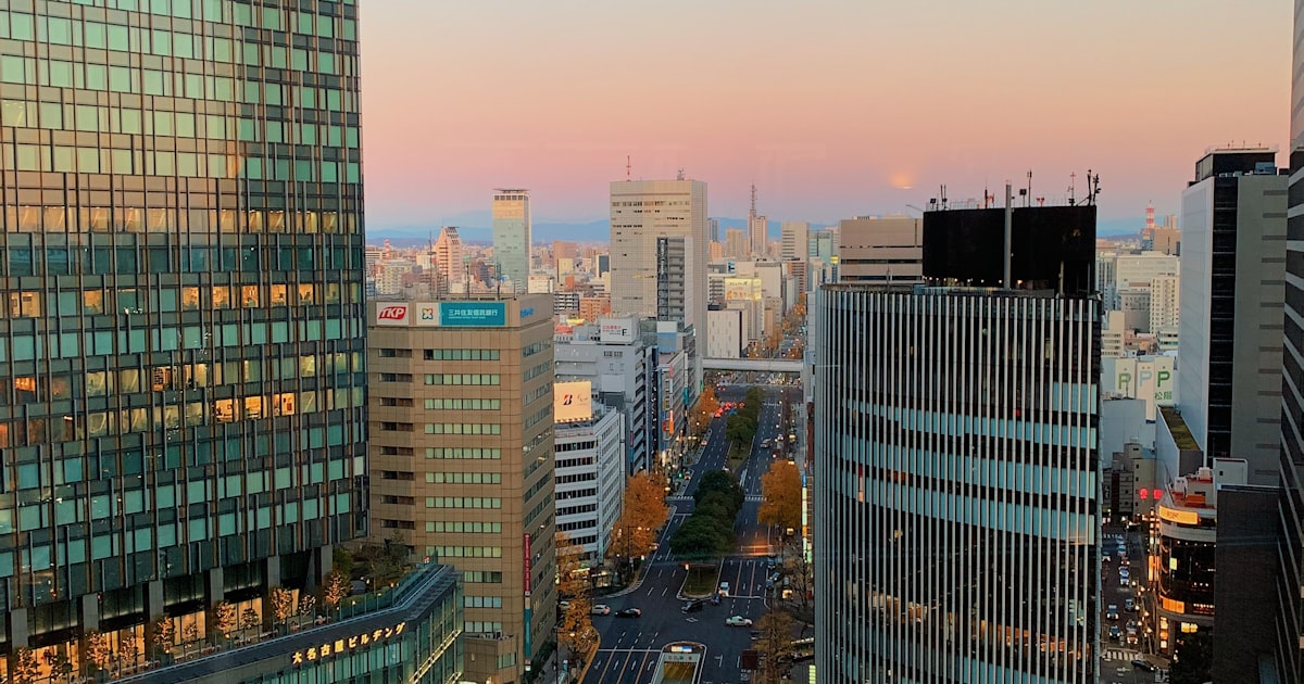
🚉 Nagoya Station (名古屋駅)
One of Japan's largest rail intersections — Tokaido Shinkansen, JR, Meitetsu, Kintetsu, and Nagoya Municipal Subway all converge here. The station is topped directly by the JR Central Towers, rising to approximately 245 metres.
The risks:
- The JR Central Towers and surrounding high-rise buildings have a large glass and facade fall radius extending well into the station forecourt and adjacent streets.
- The underground shopping malls (Esca, Meitetsu underground) face the same blackout and ceiling-fall risks as Sakae.
- When all rail lines stop simultaneously, Nagoya Station becomes a concentration point for stranded travellers — one of the largest such concentrations in Japan outside Tokyo.
What to do:
- Inside the station concourse: follow staff announcements and do not attempt to force your way through the turnstiles or exit gates.
- In the underground shopping mall: move to street level immediately via the nearest staircase exit. The Sakura-dori (桜通) exit on the east side is recommended — the approach road is wide and provides clear distance from the towers.
- Once on street level, move at least 50 metres from the JR Central Towers and other high-rise buildings before stopping — facade glass falls the width of the building's height.
- Wait on Sakura-dori boulevard rather than in the narrow side streets, and follow official guidance before attempting to travel.
🚢 Nagoya Port (名古屋港)
Nagoya Port Aquarium, the Ferris wheel (Port Building), and surrounding waterfront attractions sit at sea level — this is the highest tsunami-risk tourist area in Nagoya.
The risks:
- Nagoya Port is at approximately 0–2 metres above sea level. It is the first inundation zone in a Nankai Trough tsunami event.
- Port structures — piers, warehouses, crane equipment — can collapse during the initial earthquake, blocking evacuation routes.
- A Ferris wheel ride during an earthquake leaves passengers suspended above a tsunami-threatened zone.
What to do:
- At the first tsunami advisory or warning, leave the port area immediately — do not return to the aquarium or vehicle for belongings.
- Evacuate north and inland on foot or by vehicle. The target direction is north of Nagoya Port subway station, across the rail line, into the inland districts — aim for ground above 5 metres elevation.
- If you are on the Ferris wheel: grip the safety bar during shaking, remain seated, and wait for staff to conduct a controlled descent. Do not attempt to climb down independently. Once at ground level, follow port staff evacuation instructions and leave the port zone without delay.
- Once the tsunami warning is issued, do not return to the waterfront until an official all-clear is broadcast — subsequent waves are often larger than the first.
Underground mall escape — a step-by-step simulation
Nagoya's underground shopping networks (Sakae Central Park underground, Oasis 21 lower levels) become significantly dangerous during a seismic intensity 5 Upper or greater event. Understanding the sequence in advance saves critical time.
Phase 1 — During shaking (0–60 seconds)
- Lighting flickers or cuts out completely; emergency lighting activates (dim green).
- Ceiling panels, signage, and display cases fall.
- Action: Move to the nearest structural pillar or wall. Crouch low, cover your head. Do not walk or run — floor debris and darkness make falls likely.
Phase 2 — Immediately after shaking (1–3 minutes)
- Emergency announcements begin on the PA system.
- Fire doors in some sections close automatically — this divides the network and limits movement.
- Action: Locate the nearest green emergency exit sign and begin moving toward it slowly. Do not run. Do not move deeper into the underground network.
Phase 3 — Evacuation (3–10 minutes)
- Exit stairwells become crowded as large numbers of people converge.
- Action: Take any staircase that leads to street level — do not seek a specific named exit if it requires significant additional distance. Once you reach the street, move away from building facades and head toward Hisaya-odori Park (from Sakae) or Sakura-dori boulevard (from Nagoya Station).
Knowing where the nearest exit is before you go underground is the only preparation that matters. The underground mall connects many blocks — in darkness, memory of the exit direction is what you act on.
Before you go: quick checklist
- Nagoya Port visitors: identify north/inland evacuation direction before arriving — a tsunami warning means leave immediately
- Save Hisaya-odori Park (久屋大通公園) location — Sakae district's main outdoor assembly area
- At Nagoya Station, note the Sakura-dori east exit as the wide-road evacuation route
- In any underground mall: locate the nearest staircase exit before shopping, not during an emergency
- Save your country's embassy or consulate number before departure
- Download the JNTO Safety Tips app for multilingual earthquake and tsunami alerts
Official resources
- JMA Earthquake & Tsunami Information (English) — jma.go.jp/bosai/earthquake
- Nagoya City Disaster Prevention — city.nagoya.jp (tsunami inundation maps)
- JR Central Train Status — jr-central.co.jp (Shinkansen and local lines)
- JNTO Tourist Helpline — 050-3816-2787 (24/7, multilingual)
Related guides
- Japan Earthquake Safety Guide — First 10 seconds, intensity scale, where to go →
- Earthquake in Osaka — Nankai Trough & Underground Mall Risks →
- Earthquake in Kyoto — Timber Heritage Fires & Narrow Escape Routes →
- Earthquake in Sapporo — The 2018 Hokkaido Blackout →
- Japan Transport Disruptions — Shinkansen, flights, refunds →